Bright Night
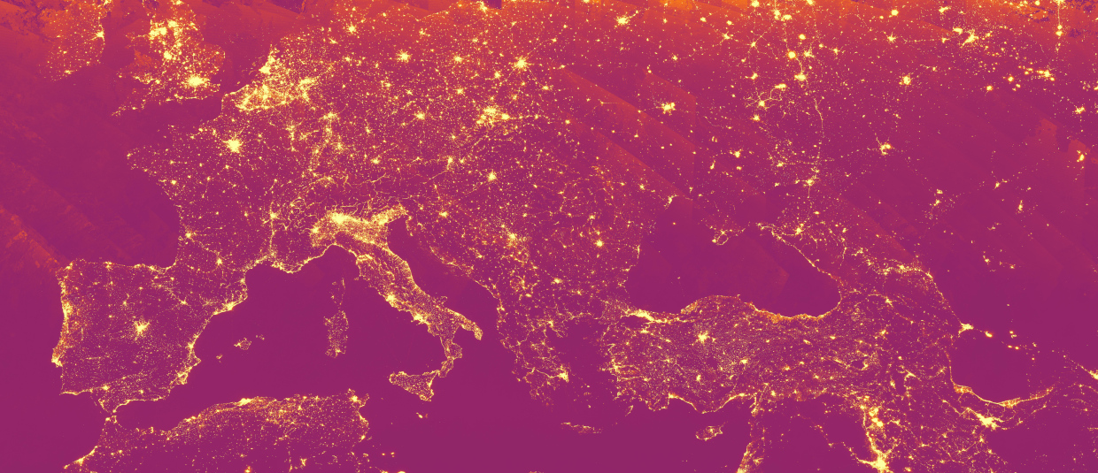
This is an annual nighttime lights image over a large part of Europe. This image shows the yearly maximum light radiation for the year 2022. Sunlit, moonlit and cloudy pixels are removed. The Visible Infrared Imaging Radiometer Suite (VIIRS) instruments aboard the joint NASA/NOAA Suomi National Polar-orbiting Partnership (Suomi NPP) and NOAA-20 satellites provide global daily measurements of nocturnal visible and near-infrared (VIS and NIR) light that are suitable for Earth system science and application studies. VIIRS Day/Night Band (DNB) data are used for estimating population, assessing electrification of remote areas, monitoring disasters and conflicts, as well as understanding biological impacts of increased light pollution. The diagonal lines reflect the swaths in which VIIRS captures its images.
Can you spot Lake Zürich? Which other regions and cities can you find?
Source: Modified VIIRS nighttime lights data / Google Earth Engine
Are you interested in this topic?
At the University of Zurich, the scientific National Point of Contact (NPOC) is located at the Remote Sensing Laboratories within the Dept. of Geography (RSS). The team of the NPOC can help you to answer uncommon questions such as night-images from satellites. several researchers are actively studying multispectral satellite images. See howDr. Claudia Röösli and her team of the EO Application and services group can help you with your satellite data related questions at the Department of Geography.
Are you a student that wants to learn more about this topic? Consider enrolling in these courses:
GEO 233: Remote Sensing and Geographic Information Science III (Basics of Remote Sensing)GEO 371: Remote Sensing and Geographic Information Science V (Remote Sensing Methods)GEO 442: Advanced Technologies and Methods in Passive Remote Sensing
GEO 443: Advanced Technologies and Methods in Active Remote Sensing