Great Bahama Bank
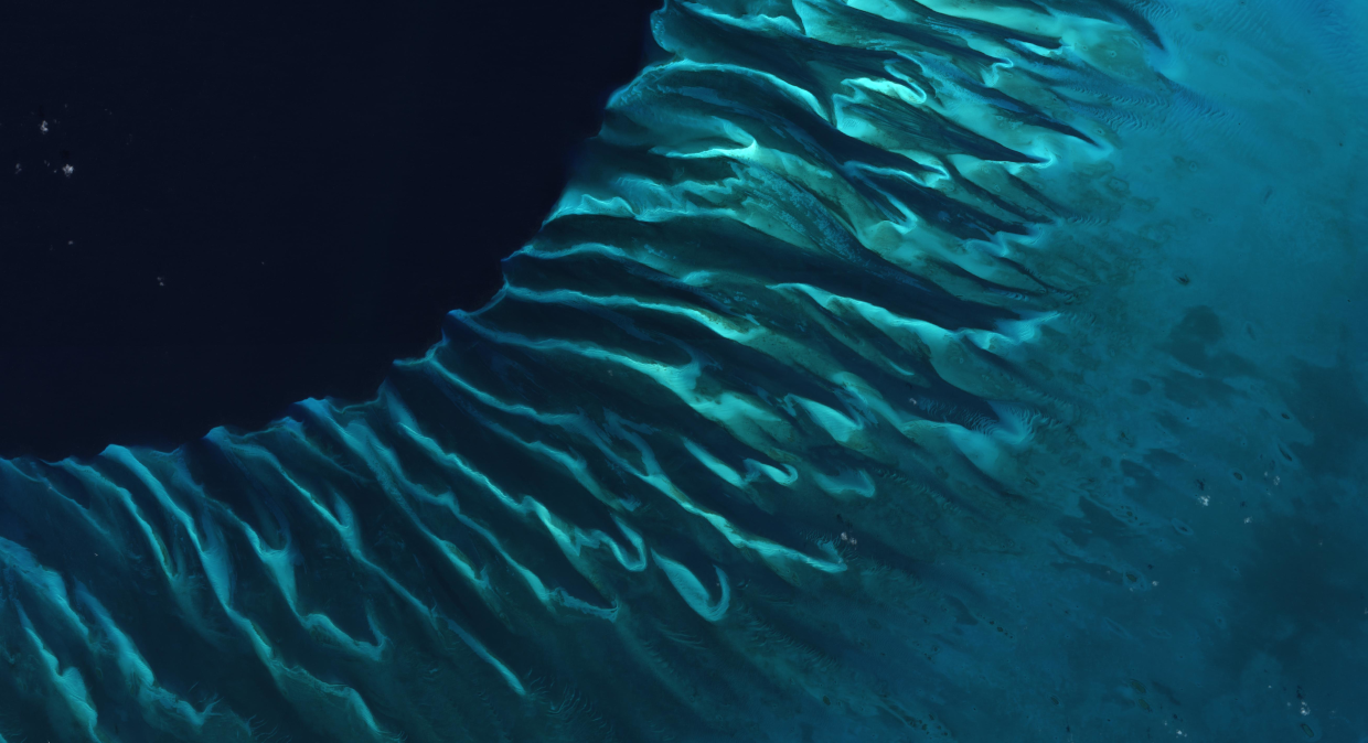
The varying colors and curves are the result of geological processes and ocean creatures. The shallow bank quickly drops off into a deep, dark region known as the “Tongue of the Ocean.” The bank itself is composed of white carbonate sand and limestone, mainly from the skeletal fragments of corals. The Great Bahama Bank was dry land during past ice ages. When it was exposed to the atmosphere, the limestone bank was subjected to chemical weathering, that created karst structures, resulting in the structures visible now here and famous so-called blue holes.
Later, the area got slowly submerged as sea levels rose. Today, the bank is covered by water, though it can be as shallow as two meters deep. The wave-shaped ripples in the images are sand on the seafloor. Sand and seagrass are present in different quantities and at different depths, which gives the image a range of blues and greens.
Researchers at UZH are investigating genetic diversity of such habitats with the help of Earth Observation satellite images and ground measurements to examine the evolution of the coral reefs.
Source: Modified Copernicus Sentinel data (2024) / Google Earth Engine
Are you interested in this topic?
At the University of Zurich, several researchers are actively studying water systems with multispectral satellite observations. See howProf. Alexander Damm at the Department of Geography observes natural water systems with his research group Remote Sensing of Water Systems.
Are you a student that wants to learn more about this topic? Consider enrolling in these courses:
GEO 233: Remote Sensing and Geographic Information Science III (Basics of Remote Sensing)GEO 371: Remote Sensing and Geographic Information Science V (Remote Sensing Methods)GEO 442: Advanced Technologies and Methods in Passive Remote Sensing
GEO 443: Advanced Technologies and Methods in Active Remote Sensing