Impact Crater Lake
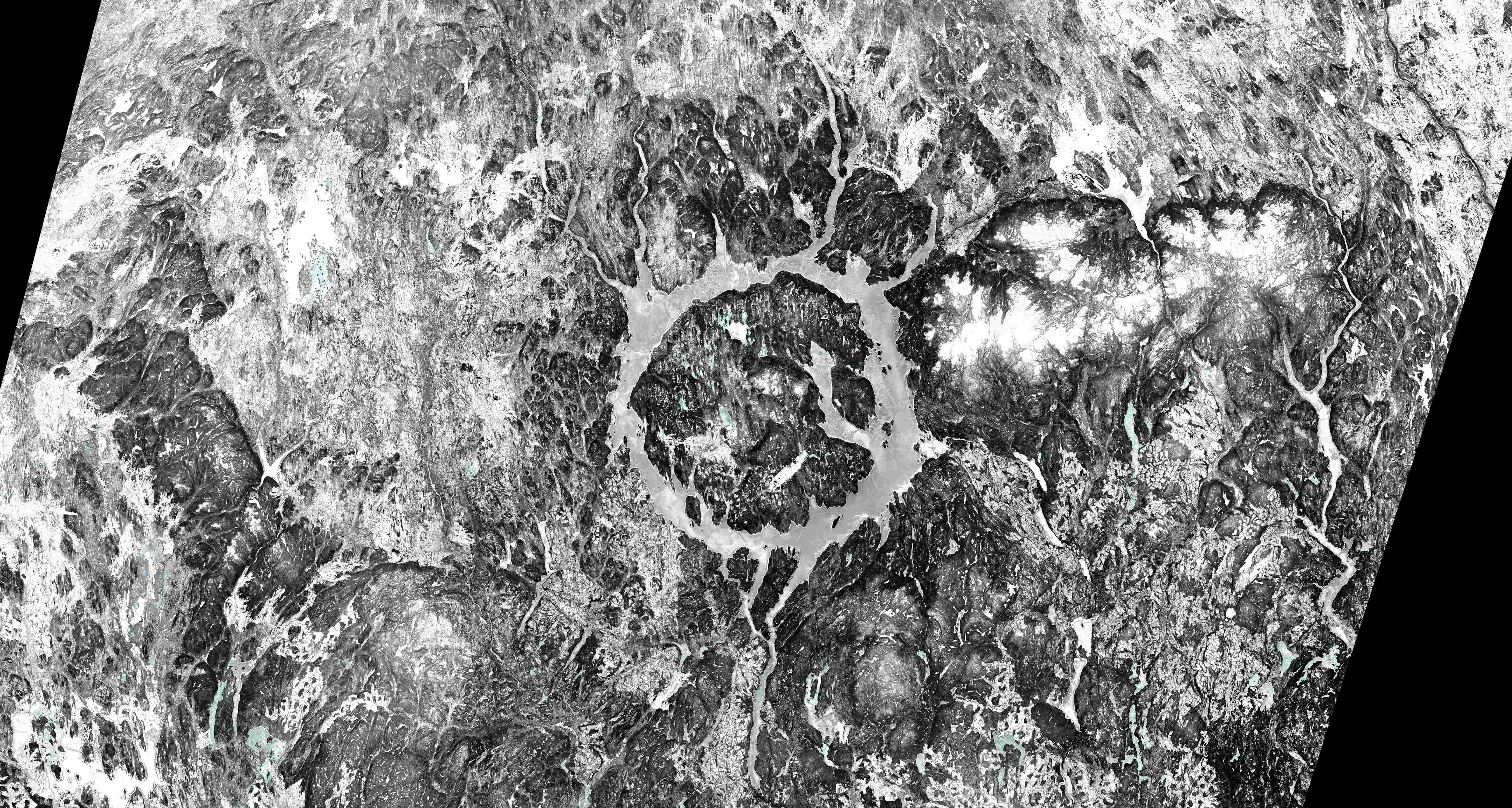
Manicouagan Reservoir, nicknamed the "Eye of Quebec" for its striking circular shape, is a testament to a cosmic encounter 214 million years ago. A 5-kilometer wide meteorite slammed into Earth during the Late Triassic period, leaving behind a massive impact crater. Today, this crater is filled with water, forming the 1,942 square kilometer Manicouagan Reservoir. In its center lies René-Levasseur Island, crowned by the majestic Mount Babel, which is believed to be the central peak pushed up by the impact itself.
This is not just a beautiful lake on a winter’s day though; it's also a powerhouse. The Daniel-Johnson dam, a multiple-arch buttress dam, harnesses the water's energy for hydroelectric power.
So, the next time you look up at the night sky, remember that the serene beauty of the Manicouagan Reservoir is a constant reminder of where space and Earth meet, and how that cosmic encounter can shape our planet in incredible ways.
If we tell you that the swath width of Sentinel-2 satellites is 290 km, can you figure out the diagonal of the lake? The swath width is the area that a satellite can image per overflight.
Source: Modified Copernicus Sentinel data (2023) / Google Earth Engine
Are you interested in this topic?
At the University of Zurich, several researchers are actively studying environmental changes and spatiotemporal patterns of climate change impacts on the cryosphere, forestry, and geomorphology. See howProf. Livia Piermattei is working with remote sensing data with her research groupRemote Sensing of Environmental Change.
Are you a student that wants to learn more about this topic? Consider enrolling in these courses:
GEO 233: Remote Sensing and Geographic Information Science III (Basics of Remote Sensing)GEO 371: Remote Sensing and Geographic Information Science V (Remote Sensing Methods)GEO 442: Advanced Technologies and Methods in Passive Remote Sensing
GEO 443: Advanced Technologies and Methods in Active Remote Sensing