Lunar Shadow
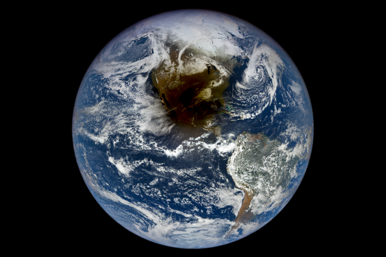
From a distance of 1.5 million kilometers away the Earth Polychromatic Imaging Camera (EPIC) on the DSCOVR satellite acquired this image of the total solar eclipse on April 8, 2024.
This total solar eclipse plunged parts of North America into darkness with the moon shadow for a brief period. The Moon's perfect alignment with the Sun blocked its light, creating an awe-inspiring night-like scene for millions of observers along the eclipse path, which stretched 185 kilometers wide.
DSCOVR is a joint NASA, NOAA, and U.S. Air Force satellite built to observe our planet from Lagrange Point 1, a gravitationally stable position between the Sun and Earth. Lagrangian points are where all the gravitational forces acting between two objects (in this case the Earth and the sun) cancel each other out and therefore can be used by a satellite or spacecraft to ‘hover’.
Source: NASA's Earth Polychromatic Imaging Camera (EPIC) on the DSCOVR satellite
Are you interested in this topic?
At the University of Zurich, several research groups are actively studying processes of the Earth. Many of them are grouped within the Remote Sensing Laboratories. See howMaria J. Santos is researching the interaction between human and its social interaction with the environment and the Earth as a system with her research groupEarth System Science at the Departement of Geography.
Are you a student that wants to learn more about this topic? Consider enrolling in these courses:
GEO 233: Remote Sensing and Geographic Information Science III (Basics of Remote Sensing)GEO 371: Remote Sensing and Geographic Information Science V (Remote Sensing Methods)GEO 442: Advanced Technologies and Methods in Passive Remote Sensing
GEO 443: Advanced Technologies and Methods in Active Remote Sensing