Minnesota in Winter
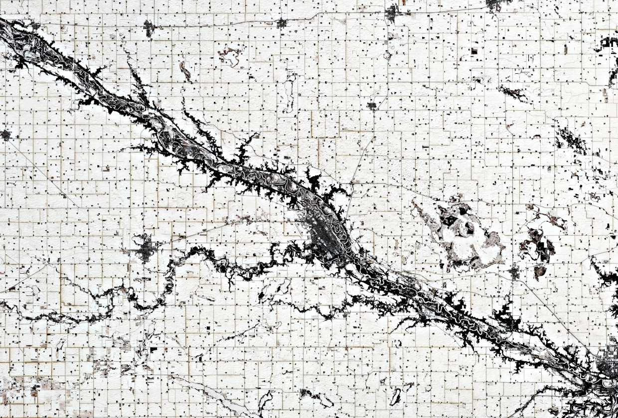
A snowy Minnesota, with the city of New Ulm (ca. 14,000 inhabitants) in the center, at the confluence of the Minnesota River (north) and the Cottonwood River (west). On the west side of the city the New Ulm Municipal Airport is visible.
The meandering Minnesota River occupies only a small portion of the wide valley, which is up to 8 km wide and 80 m deep. This valley was carved into the landscape by the massive glacial river Warren between 11,700 and 9,400 years ago at the end of the last ice age in North America.
The very regular, agricultural grid pattern reflects earlier surveying; the size of the fields was determined by the need to have a big enough area to make use of machinery efficient. Nowadays, satellite imagery is increasingly used in agriculture, to support precision farming and to estimate future crop yield.
Fun Fact: Back in the year 2000, New Ulm was voted “the most German town in America.”
Source: Modified Copernicus Sentinel data (2023) / Google Earth Engine
Are you interested in this topic?
At the University of Zurich, several researchers are actively studying SAR technologiees. See howDr. David Small, andDr. Elias Mendez at the Department of Geography reasearch in the domain of SAR technology as part of the research group Remote Sensing of Water Systems.
Are you a student that wants to learn more about this topic? Consider enrolling in these courses:
GEO 233: Remote Sensing and Geographic Information Science III (Basics of Remote Sensing)
GEO 443: Advanced Technologies and Methods in Active Remote Sensing
GEO 371: Remote Sensing and Geographic Information Science V (Remote Sensing Methods)
GEO 442: Advanced Technologies and Methods in Passive Remote Sensing