Sundarbans Mangrove Forest
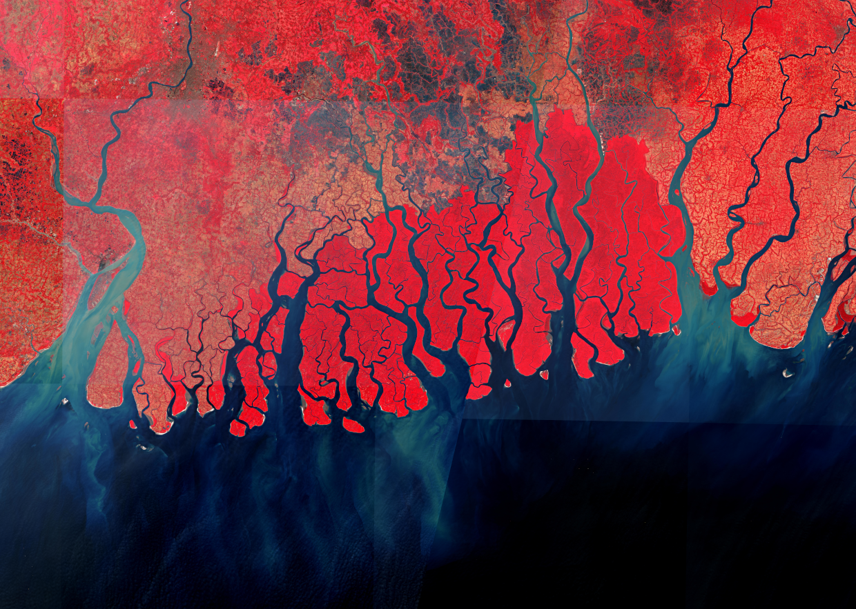
Sundarbans is a mangrove area in the delta formed by the confluence of the Ganges, Brahmaputra and Meghna Rivers in the Bay of Bengal. It is the largest mangrove forest in the world. The bright red appearing Sundarbans mangrove forests span ca. 150 km east to west!
This false color image uses a combination of near infrared, red and green bands of the Sentinel-2 satellite. This combination of bands is most commonly used to assess plant activities and health, as plants reflect strongly near infrared light while absorbing mainly the red light for their photosynthesis. Since they strongly reflect near infrared light, plant-covered land appears deep red. Cities and exposed ground are gray or tan, and water appears blue or black.
The image reveals the intricate beauty of these mangrove forests. From the towering mangroves to the hidden waterways, this fragile ecosystem teems with life. Researchers from the University of Zürich are involved in studying the rehabilitation of managed mangrove ecosystems using remote sensing data.
Source: Modified Copernicus Sentinel data (2024) / Google Earth Engine
Source: Modified Coper
Are you interested in this topic?
At the University of Zurich, several researchers are actively studying water systems with multispectral satellite observations. See howProf. Alexander Damm at the Department of Geography observes natural water systems with his research group Remote Sensing of Water Systems. Check out his article on his research of mangroves and rainforest.
Are you a student that wants to learn more about this topic? Consider enrolling in these courses:
GEO 233: Remote Sensing and Geographic Information Science III (Basics of Remote Sensing)
GEO 443: Advanced Technologies and Methods in Active Remote Sensing
GEO 371: Remote Sensing and Geographic Information Science V (Remote Sensing Methods)
GEO 442: Advanced Technologies and Methods in Passive Remote Sensing